Tuesday, 8 June 2021

2021 Trip

The Great Escape.

Someone once said to me “you can plan all you want, but God will decide.”

Well, it appears God did decide! Or at least Covid -19 and the politicians decided. 

Due to leave on June 1st, the Victorian government called a snap lockdown for ALL Victoria. It was now the 27th of May. Following this information, I stamped my feet, swore a lot and made the instant decision to throw (literally) clothing and food into the, already prepared van, and head across the state border before being locked in. I wasn’t prepared to waste another week of my life in a lockdown, which didn’t even affect our region of Victoria.

The closest state border for us was 3 hours away, so we needed to go and go fast. We tried to rally the other parties who were coming with us to do the same, but for various reasons we were the only ones to make it out in time. (They sit at the border as I write, waiting for restrictions to ease and maybe, make the journey across. We are now in Queensland!). 

Our trip was not originally in the direction of Queensland. We were to follow my Mother’s journal. My father, mother and a couple of others made the trek across the Central Desert Road into Western Australia in 1992. 

We were to follow their travels, trekking up the Oodnadatta Track, into Alice Springs, onto Uluru before heading west into true desert country. 

I found my Mum’s journal before she passed away some 4 years ago and after reading bits and pieces remarked on how intrepid they were almost 30 years back. Yes, they had four-wheel-drives back then, but few other conveniences. We now have our off-road vans, with toilet, shower, washing machine and microwave! I wonder what Mum would think of all this?

Warri Camp NSW

As I said, we high-tailed it out of Victoria and spent the first night on the road being buffered by high winds and cold weather. Sleet greeted us the next morning. One other couple came with us in a last-minute rush. Not in the original party, but friends nevertheless. 

We travelled up the Monaro Highway, with sleet and small patches of snow finding its way to the ground. The heater in the car on full tilt! We wanted to avoid all major towns and instead of trying to go through Canberra, circumnavigated the entire state via some outback roads and some wonderful scenery. Snow had stopped by now and the vistas from the top-of the-world were spectacular.


Our next camp was by a river with large River Red Gums for company, along with some others panning for gold. The company was good, the fire burned brightly and all was good with our life. The only issue I had, because the other parties hadn’t made it out, was guilt! 

One of the gang initially coming, asked if we were stopping at Cann River on our way out? My response was “NO! Just get across the border ASAP!” They didn’t make it!

Ponto Falls Camp NSW

This feeling of guilt haunted me for quite a time, before I came to realize, we have choices in our life. Some choices are hard to make, especially when it involves others; some are easier, usually as an individual. Some choices are made for you and you need to adjust. Such as the choice not to go to Western Australia as originally planned. 

With state borders closed and permits required everywhere you go, outback roads impassable due to rain in the regions, we felt our choice to go to Queensland was the best option for us. 

Yes, we did some mice at Ponto Falls. Check the top of the tyre.

I now sit in sunny Queensland with the birds and the tress surrounding our camp area. Only three others in the area, so very peaceful.


The friends we initially came with spent about a week with us in NSW, before heading to Sydney to see their son and have now returned back to Victoria. We spent some wonderful time with them along the Macquarie River near Dubbo, at a place called Ponto Falls. Birdlife was amazing from Corellas, Galahs, Apostle Birds, Willy Wagtails, Pelicans, Ducks and so forth. Big River Red Gums once again provided the frame for the river behind, making our view magnificent. 

Artesian Bore Cunnamulla QLD

We cooked up a feast with camp oven tucker: Stew, which lasted for 3 days! Linda made rissoles and chips another night and we even had roast chicken, with crunchy potatoes in foil. Got to love outback cooking!
Then our time together was up and each went their separate ways. They to Sydney, we north-west, heading to Cobar.
As all outback roads were closed, due to rain, our plans to meet the others were thwarted twofold. One, they were still stuck on the Victorian border and two, we had no way to get to Menindee where there was a chance to rendezvous. Once again, a sad choice was made to no longer wait for our friends, as they still hoped to go to Alice Springs and Uluru. When and if they can, we still don’t know.
I didn’t want to try for a South Australian and Northern Territory border pass after the Lepers we are from Victoria! Getting a NSW and Queensland one is bad enough. And the good thing about Queensland is, we haven’t seen much of it beforehand. The other positive is, our son lives in Cairns. As we haven’t seen him in eighteen months and thought it was a good opportunity to catch up. Maybe this whole trip has been fortuitous.  
Crossing the border yesterday we travelled onto Cunnamulla. Our first stop for purely tourist purposes. Taking in the video at the Info Centre about the Great Artesian Basin, was fascinating. Then some sustenance before walking the 1.5km bushland walking trail, finding out about the indigenous trees to the area and their purposes. Both in the European and aboriginal aspects. Our final tourist site was photographing the ‘Cunnamulla Fella’. 

We are now travelling west and are hopeful of finding opals at Eulo. And maybe dinosaurs at Winton, or one of the many other places which seem to have these prehistoric monsters hidden beneath the ground. Sounds exciting to me!    

Tuesday, 6 August 2019

Part 8 - Final for 2019

We made the Tip! Wahoo, after a false start 5 years ago, the mission has been completed! 
We have now started south again for the final leg of the Cape and then home. But let me retrack a bit first.
After departing Weipa, we headed north, past the Andoom Mine (Rio Tinto) and onto the little community of Mapoon. Aboriginal owned and run this little township was a picture to behold. Flowerbeds at either entrance, little rubbish and a very colourful Café. The only downside was the number of dogs freely roaming the streets – in packs! After picking up our Park Pass to Cullen Point and a nice coffee, we were on our way out to Old Mapoon. Old Mapoon is known as the site of first contact between Europeans and Aboriginals of Australia. A Dutchman Janzoon, in 1606 had two encounters; the first friendly enough, the second not so friendly. After navigating and mapping along the east Carpentaria coastline, he decided he didn’t want to know much more about the place. Obviously, he couldn’t recognise Bauxite or didn’t understand its uses, else he may have staked a claim. 
Captain James Cook in 1770, made note in his journal that although he claimed Australia as we know it today, for Briton, he was aware the Dutch (and Spanish: Torres) had been here previously and maybe they had first claim on the land. Needless to say, the British Navy didn’t like that thought and edited it from the journal. 
Later in Mapoon’s history, the missionaries came and tried to save the native souls, bringing in many islanders, and other tribes from surrounding areas. It was also the time of the ‘stolen generation’ with many displaced children being taken from their families. 
Old Mapoon was then ‘relocated’ to near Barmaga (on the Tip) in 1963, after the Queensland government and Comalco, (forerunner to Rio Tinto) signed a document. (Not sure on the politics on that one)! Several years later some of the original owners of Mapoon went back and claimed their place in the world.  So today we have both – Mapoon and New Mapoon. 

Now Cullen Point was an interesting place, sitting at the mouth of the Wenlock and Ducie Rivers (East side) and Gulf of Carpentaria (West side). Our camp site had waterfront views over the two rivers and gulf. Thank goodness we were sitting out on the tip as a gentle breeze blew most of the time cooling our 30C day. The site was white/grey sand, and reflecting from the ground made it extremely warm. Our traveller fellow, under instruction from hubby made his way around to his sight, but unfortunately became bogged in the sand. Never fear! The winch was swung into action as the two males were now in their element. No 4WD adventure is complete unless you get to use your winch – apparently!
Following a few tense and harrowing moments for the onlookers, all was back to the way it should be. Winch safely tucked away hopefully not to be used again on the trip. It was now time for the boys to unload the boat and test their ability at the angling side of things here. Weipa had proved slightly successful, maybe the gulf and two rivers would be more fruitful. After travelling in and out of channels and rivers only a handful of Spanish Mackerel could be caught. On return to shore, they thought it a good idea to try their hand at ‘shark fishing’. Not a very bright idea, I thought, as many sharks inhabit these areas. Our neighbours, trying their hand at Fly fishing, were being chewed off, almost every cast. Hubby did catch one shark (you could see the fins), but it broke the line. To encourage the sharks closer, they enticed it with the Mackerel, caught earlier. Well it worked! In comes a shark, no further than 6’ from the shoreline. Swimming merrily about, devouring all the dead fish caught. All 3 fins of him! With the show over, it was time to make for home. Boat reloaded and a quick look for turtle eggs. (Our neighbours were walking the beach the previous night and saw two turtles). We found no sign of turtles, but the ‘logs’ on the beach opposite appeared to move greatly! Once again up here, fabulous beaches but also deadly; shark, croc, stingers.
Next morning the breeze had turned into a moderate wind and time to move out if we didn’t want to be sandblasted. Back into Mapoon, (one more coffee) through Weipa (one last time) and onto York Dam for the night. A wonderful place beside a dam, specially put in for tourists from the York Station (a few kms further down the track). A ramshackle toilet (door off) but beautiful blue water in the dam. If adventurous enough you could swim. 
Next morning, we were seriously going to the ‘Tip’. No more detours, no more ‘let’s look at this’… to the TIP! We were now conscious of time, and the lack of it, if we were to be home late August. 
One of our beautiful sunsets

Out of York Dam, we made a short-cut through Batavia Downs (the original Station encompassing Weipa). We travelled quickly as the dirt road was well pressed with few corrugations.  Turning onto the Peninsula Development Road (Cape) and we faced a whole other road. Rough, corrugations and dust! A few more kms up the road and we spot the Moreton Telegraph Station. Time for reprieve and to see the old station and what it has to offer. Yes, more coffee but also some great paraphernalia of the overland telegraph from Cairns to the Tip. We also spotted a poster of the Steve Irwin Habitat for the Wild. An area reserved for wildlife between the Wenlock and Ducie rivers which used to be the Bertiehugh Station. They have researchers from around the world come to work out here. Who knew?
We by-passed Bramwell Station and continued on the PDR (Peninsula Development Road).
Fruit Bat Falls - the closest we came to the OTR (Old Telegraph Road)
Our male traveller thought we could check out ‘Gunshot’ on the Old Telegraph Track, but we put our foot down and left him in more dust! Corrugations really started to beat the tyres, car and van around now, slowing us to 20kms most for the time. Will we ever get there? A slight reprieve with some bitumen, made it bearable as we finally tumbled into Jardine River, ready to camp and obtain our pass across the ferry and into NPA land. 
A pleasant camp overnight then it was onto the ferry. OMG! 
The ferryman was extremely pleasant. Hubby had already been down the night before to check out the approach and exit from the ferry. A friend our ours a few years back bent/broke his towbar getting on/off this ferry. I was not looking forward to this. 9 minutesfor them to cross we were finally on the last leg of our journey. 
Jardine River Ferry 
Stopped at the sign before being directed to enter the ferry, I’m trying to remain calm. Underneath the exterior the pulse is rising and heart palpating. The man on the ferry gives a hand signal directing ‘come down’. Turn tyres this way, then back again, then straight ahead. I think we are about to run off the ferry before hubby finally stops. I let out a not-so-silent STOP! He finally pulls up, turns the engine off and pulls on the hand brake. We are on our way, by ourselves. We leave the others, in their Kimberly Caravan, behind. Obviously, the Ferry Drivers know ‘class’ when they see it! Coming off the other end was not as harrowing. We were back on terra-ferma and now it was my turn to video the others doing their crossing. After waiting 
Before arriving to find our camp site, (yes, I know) we detoured to the WW2 Aircraft monument and crash-site. Then onto the Seisa Airport (for a look) and over the airfield to see some more old relic plane crash sites and fuel dump.
WW2 Airplane crash
Finally, we turn into Bamaga for a few essential items before heading out to Umagico Caravan Park, finding a lovely spot with beach frontage and light breeze. The sunset was a bonus. As it was only early afternoon, we unhitched and took a short trip to Injinoo to check out boat ramps and fishing spots for the fellows. A few lures were tossed around, to no avail. The slide marks on the bank at one lonely site had “CROC” written all over them. We learned later a big croc had been shot at this site a few weeks earlier. He was being of concern to the locals and (dogs). Intelligent Croc had worked out when the school bell rang, children would run down to the water and throw their non-eaten lunches away. He had already taken a dog and now the community was at risk. The only solution – BANG!  
With no fish and no incidents with crocs, it was back to camp to enjoy happy-hour and the sunset. Tomorrow “THE TIP”!  
The road to the tip was also unexpected as we found our way through rain forest and hills, over water crossings before finally parking below a huge pile of sandstone rocks. These rocks in the form of hills formed our walking path out to the edge of the Torres Strait and the final assault on the ‘Tip’. As per our entire journey we were buffeted by wind as we clung tightly to the sign that says “you have reached the most northernmost point on the Australian continent”. It was a strange emotion I felt holding this pole. I was relieved that I had accomplished what I set out to do, but I also felt let-down somehow. Is this all it was? Why was I so driven to be here? I worked out it was the fear of missing out. When my previous trip had been so disastrous, I felt everyone else had seen something I hadn’t and I’d missed out. I’d been disappointed and dejected for months after this, until they returned with tales of their adventures. Now it was my turn and I truly believed the journey had been the important part. The destination was just the cream on top. 
We made it!

Our journey to the Tip was completed but we were to experience more culture of the top-end when we booked a trip to the three islands in Torres Strait. Friday island where a Japanese man had made his home for the past 26 years. He was also a pearl dealer, who cultivated his own pearls after buying out a lease from a previous pearl famer. His place was in the true Japanese style, with raked sand in the garden beds and many Japanese icons around the place. A very peaceful place as he had the whole island to himself (and the 5 Japanese back-packers for five months of the year, helping in his small shop and around the island). Once a week he would make the trip over to Thursday Island to do his shopping, and once a year he would go back to Japan to sell his wares and see his 92 year old mother. 
Next on the boat trip was Thursday Island. Being a Sunday most of the shops were closed, therefore after a quick taxi ride around the island and a very informative chat from Dirk (our driver), we headed for the pub. Not any old Pub, but the ‘most northernly in Australia’ pub!  
What we did see of Thursday Island was beautiful. The water a simmering turquoise and white sand made for a spectacular view from the old fort atop the hill. Pity about all the sharks, crocs and other nasties. 
Friday Island - pearl farm

Thursday Island bus shelter

The cemetery was very interesting too, as the TI people have what the call an ‘unveiling day’. After the burial, the family save their money for a granite or marble headstone, with a small history of the person engraved on it along with their name. By the time the headstone is completed and sent back to TI, the family put on a big celebration and unveil the headstone. No one is to see the headstone before the unveiling. 
There were also many Japanese headstones in one section. This was due to the influx of enforced labour of pearl divers in the early 1900’s. The graves had been in disrepair for some time and only now are being restored to their previous standard. 
The final island for the day was Horn Island. Horn Island was home to many servicemen and women of the period of WW2. There is a great museum on the island of all sorts of interesting documentation and pictures from this time, including from the Japanese perspective. Some photos quite evocative and emotionally disturbing.
The picture says it all! How sad.

By now all our bodies and minds were beginning to wain and were looking forward to our boat trip home. But not before some of the people on the trip decided they needed to stock up on a ‘slab’ or two! Their reasoning – cheaper here in TI, than in Seisa.
Although the boat trip home was a bit rough, it was very similar to the conditions experienced at times on our own Gippsland Lakes. Because the Great Barrier Reef surrounds this place, the waves are mostly choppy and not large. We arrived home safely and were now ready to start the trek southward. 
With a sense of sadness in our hearts, the car now headed south. We made good time down the PDR with all roadhouses being serviced with our money; either going up or coming back. Musgrave doubly so as we camped and ate out, up and down the track. The final assault for our Cape York adventure was to turn off at Laura toward Battle Camp Station.  The road took us 4WD past the outskirts of Lakefield NP. A few water crossings, up and down the Great Divide and we were now close to Cooktown. A minor detour out to Hopevale; a lovely community set amongst rainforest and green grassy paddock, before we arrived at our destination for the evening.  
Cooktown was very different to what I had imagined. In my mind it would be a large community. Instead it was quite small with a few hotels, small shopping strip and one IGA supermarket. It also contained much memorabilia of Capt. James Cook and his exploits in fixing the ship Endeavour. The museum, set in an old convent, was very well set-up with artefacts displayed from by-gone eras of gold mining, the township and the convent days. James Cook also received a mention, anchor and all!
A quick look to survey the countryside and ocean, from the top of the Grassy Hill, after being nearly blown away, we then scooted out to the Botanical Garden. Checking out the small shopping precinct, fellow lady traveller spent a few dollars on a pretty iridescent necklace, before we all headed to the local establishment for a not-so-quite ale. (The music on the jukebox was exceptionally load). 
Cooktown lighthouse 

After consultation with our travelling troupe (the other two), we decided to leave our Cooktown camp late afternoon, to head down the track to a little place called ‘The Lion’s Den’. The Lion’s Den is just off the main road from Lakeland to Cooktown, but it is also the start and end of the road for us to be able to attempt the infamous, ‘Bloomfield Track’. 
Many people we met gave us conflicting information on the track conditions. Was it suitable for caravans? Yes, no, maybe came the responses. Our fellow female traveller resorted to the information pack and read “it has 32 kms of gravel, corrugated and steep slopes. 4WD only, with several water crossings.” (All okay so far. We were feeling just a tiny bit smug with our other 4WD exploits).  But the thing that swung the vote was “inclines and descents of up 31% in places”. This statement became our deal breaker for taking any vans past Lion’s Den.
The trip over the Bloomfield lived up to its reputation. Yes, on the really steep parts there is concrete to help you not slip. But they forget to tell you about the right-hand corners on the 30% incline and the rough washouts when you meet another vehicle. Or maybe the overhanging trees that would wipe out your air-conditioner on the van. The risk was certainly not worth the angst. We had certainly made the right decision. 
On entry to the other side we found civilization at Cape Tribulation. (Another Capt. Cook historical place, but also a pretty beach with coconut palms). A tour down the road, we checked out Cow Bay and the Daintree Rainforest but the elusive (or imaginary) cassowary were not to be spotted. 
We had friends in the Daintree area and finding some phone coverage were able to make our way to their hideaway in the rainforest. A pleasant hour was passed in conversation with these two before showing us their ‘slice of heaven’. 3.5 hectares of rainforest with ferns plentiful and the vanilla beans (of which these two are famous for). Unfortunately, the beans had finished for the season with only the empty vines hanging at present. 
It was now 3:30pm and we needed to get back on the track if we were to make home before dark. The drive back was uneventful. We even made better time back than coming over. Funny that!
Friends in the Rainforest 

One last diversion on the track was just before Wugal Wugal (another well-kept Aboriginal community), where we went into see the Bloomfield Falls; a towering mountain of freshwater flowing over granite rocks.  A crocodile was sunny himself on the other side of some rocks. So even though the water looked inviting, I thought I might decline the invitation.
We finally made it back into camp by 6:00pm, just before dark. The only thing left to do now was… have a drink and meal at the legendary Lion’s Den. One very iconic Australian hotel. And being a Saturday night there was music as well. All is good with the world from this vantage point.
Well we have finished our exploits in the FNQ. We caught up with our son in Cairns and have made it into Townsville to spend some time with my brother before the final assault on heading home. We may stop and say hello to a few other friends up this way, but more than likely the hubby will want to push for the home town lights. 
This will be the last chapter in the blog for this time. Until next time, I will sign off wishing you all safe travels and happy memories.    
                              

Monday, 22 July 2019

Part 7

Weipa. What an amazing place! Rio-Tinto owned and managed, with green grass and picture-perfect sunsets over blue gulf water, it certainly doesn’t get much better. 

Being on the road for quite a few days, it was time to restock everything – food, fuel and restore some clothes with washing. The first day was taken up with - 1. Boys – fishing. 2. Girls, domestic stuff, plus a walk and internet bits and pieces (before the system went down). 

Day two started early with a bus tour around the town and mines. A three-and- half hours trip went by very quickly as our driver, Hardus (think either South African or Dutch), informed and entertained us. So much information, it is hard to retain much of it. Suffice to say it was extremely well worth the CASH we had to pay.
The mineral mined here is Bauxite which is transported by boat overseas and other parts of Australia. The channel the boats must come through is shaped like a tennis racquet. They cannot turn the boats, therefore have to come in one way, load and go out another way.  The channel is only 13 metres deep on high tide mark. It was made this particular height, with dredge, due to Torres Strait being 13 metres at its lowest point. The boats must navigate this Strait as well on their trips out of here. The boat size is classified ‘Post Panama’ due to the size of boats which can navigate the Panama Canal.
The Bauxite is the world’s largest supply and according to our guide, they have only touched 9% of the resource so far. It is estimated it would take another 500 years to remove all the mineral on current predictions. 


Bauxite is the mineral to produce Aluminium. It is very simple to mine with no pits or explosives required. You simply run your loader over the top to remove the product. This in turn is loaded into either truck or train, and transported to the hopper to be unloaded onto a conveyer belt. The conveyer belt continues on its way until the processing plant. Only high-pressure water is required for processing, along with a few good shaking machines and the end product is then ready for export. No chemicals required for bauxite, just good old water. 
The main workers in the driving department are female, due to their driving skills. Not as harsh on machinery (taking things quieter, not rush and tear) and also more aware of machines needing maintenance before actually breaking down. Nothing like a bit of Girl-Power!   
There are no FIFO workers here. All mine workers have to be live in the township. This was part of the contract between all parties (Mining company and indigenous landowners). The indigenous felt if the town was to be supported, the mine had to be the major supplier of everything. Roads, shopping precinct, schools, industry and so on. The community is home to around 3000 people; therefore, it is a very socially active town. Marathons, Bull Riding, Hunting and Fishing Competition are the major events the town is known for. 

The last crocodile attack happened in 2011, when one fellow fishing in a small stream (just below the caravan park), was grabbed by a 4-metre croc. Some lads at the local hotel heard his cries for help and came to rescue him. The fellow was holding onto the mangroves near the bank trying to prevent his demise. This croc was ‘relocated’. (Shot and buried at the local dump). 
Well it’s almost drinks time and as I can’t post the blog today will have to wait for the internet to be up and running again. Until next time…


We just got back online and as we are out of here tomorrow will upload this latest couple of editions. 

Part 6

Part 6
“I think we might make a trip out to Portland Roads” I say, standing on the intersection that can lead either to the ‘Tip’, back to Cairns or out to Portland Roads and Lockhart River. “It sounds an interesting place, with quite a bit of WW2 history. Might we worth a look”. We are already very familiar to gravel, dust and corrugations therefore nothing we haven’t seen before!
After picking-up with our new travelling companions, we did our last stock-up of good, fuel and water before ascending North for our intrepid journey to reach the top of Australia. Early days into the trip had been very uneventful. The road was bitumen and not as we had expected; more climbing the Great Divide than anticipated.
Following the mountains for most of the way, with the occasional flat savannah to break the scenery. We free camped the first night out; in a gravel pit (as you do), beside the road. An hour into our quite little hideaway and we see two more vans making their way towards us. “There goes our peace and serenity” one fellow traveller commented.  Although it was not what we really wanted, the company was good, with chat among the visitors and ourselves robust. 
The following night we stayed at Musgrave, a small outpost from a bygone era of the overland telegraph (Qld).  This old station has been turned into a place of respite for weary and dusty travellers. A small café/restaurant made a pleasant reprieve from the cooking. The hot showers were wonderful taking the layers of red dirt from under the fingernails, skin and the hair. Following our night of ‘luxury’ we were on our way again. 
I’ll admit here, so far into this journey, beside the scenery I was disappointed in our trek to the top. Beside the mountains and roller-coaster roads, it was…well boring to a certain degree. The road was bitumen a lot of the way, with patches of gravel to make sure you were awake, but nothing out of the ordinary. 
When other travellers from our pervious attempt went to the ‘top’, some of them felt cheated in some way. They felt for various reasons, they had rushed the trip, missing side-trips along the way. Their recommendation to us was “make sure you do it right. See everything you can”. I was beginning to think they were right; we needed a diversion hence the intersection to Portland Roads.
As we trundled down the roads, we really had no concept of what we were to encounter. The first part of the track lent itself to some burn-off of vegetation, making the termite hills standout, like ‘boot-hill’, in this black environment. There are various types of anthills; the ‘standard’ red dirt, to the exotic type of the magnetic. These ants build their empires of dirt in a north/south direction. This type of hill is used in swampy areas to alleviate heat stress in the nest. In the morning the ants migrate to the west, evenings to the east, for the cooler area. I guess you could say environmentally aware ants!
Once through the burn off area we encountered our first water crossing on the road. A mild stream a few metres wide, with good rock bottom. After many dips and twists we finally arrived at the Wenlock River.
After an easy entry we crossed the river following the concrete causeway underneath. The exit required a bit more navigation, as the slippery conditions from the water we carry through, and a couple of bumps made the Totoya and BT rock and roll. 
Our female traveller is not an adventure junkie in any sense of the word, so her initiation to true 4WD on this trip was just activated. 
After crossing the Wenlock, we decided to traverse a few kilometres to a camp site run by the local indigenous people. A campsite with plenty of space, a toilet and ‘donkey’ shower greeted us.  On arriving we were welcomed by a lovely lady who, along with a party of at least 6 others had been here for the past 3 weeks. She explained the ‘donkey’. The shower is hot, as long as the water is heated. To heat the water, create a fire in the stove. When you finish your shower, make sure you throw another piece of wood on the fire as you leave.
After these short instructions she then proceeded to tell us why they had been here three weeks. The party is an archaeological team, with all members doing their PhD. Even the Professor was present, assessing their skills along the way. They apparently did find some artefacts of significance here, which the Elder of the people was very excited about. Much of the history of his place had been either destroyed or hidden with overgrowth of vegetation, over the past 150 years. 
We did speak to her about the road into Portland Roads and Chilli Beach (Iron Range NP). She informed us the road was reasonably good, with occasional water crossings, and patches of bitumen. The Café at Portland Roads had a good reputation, but was closed on her venture yesterday! Lockhart River was quite a shock to her, but was the only place you could fill for fuel and supplies. 
Next morning, we were up bright and early ready for our new escapade. But not before my dear hubby had decorated the next-door caravan with streamers and balloons. It was female traveller’s birthday. Happy birthday V! Pancakes were on the breakfast menu today to add to the celebratory mood. 

After the camp lady had told us it would only take around 90 minutes to get into Portland Roads, we didn’t understand how she could be so wrong in her timing. It turned out to be a 4-hour one-way trip after many water crossings, Pascoe River included. The last of the journey included so many potholes, trying to dodge them was almost a waste of time. There were places where 4WD was absolutely necessary with some of the entries or exit to the crossings horrendous. White-knuckle fever present around most corners or dips. We travelled slowly until the bitumen section where a bit more speed was warranted. No damage to either van or car was our aim. We still needed to return! And this was a very remote part of the Cape, let alone Australia. 
Travelling through the last of the rainforest we came upon Portland Roads. What an oasis in this forbidden part of the country!  Manicured laws, swaying palm trees and newly varnished park seating. The surrounding mountains of Portland Roads added to its mystic. The ocean lay in front of us with opening arms. Alas, no swimming due to crocodiles! The old ruin of the port jetty could only be made out in the distance. A few broken wooden piles and iron nails all that remain. Once a thriving military base, Portland Roads was home to many air force and army personnel, being the main port for the FNQ detachments. Japanese subs patrolled the inner reef, destroying many of our allied ships in this area. Who knew?
The café was a quaint place set halfway up the mountain with a view over the cove and water. We spoke to the lady in charge and booked in for the evening meal. Pre-booking Male and Female traveller had the seafood platter. I, the garlic prawns with fettucine, hubby – fish and chips.  A wonderful way to celebrate V’s birthday. One I’m sure she will remember for a very long time.
Remote location, starry night, good company (I hope) and a romantic husband to boot. What more could a girl ask for? That night though we did have to free camp. Shhh! Don’t tell anyone. You are supposed to book for the NP, but seriously how would you know what the place was like unless you check it out first! Next morning, we went back to the entry to Portland Road to take a picture of the van, proving we did actually go there. After talking with one of the Shire Council workers he said “we were the first caravans we had seen in 2 years to make it in”! 

On waking the next morning, we wound our way into Chilli Beach. White quartz sand, coconut palm trees and a stiff sou-easterly wind blowing, greeted us on this beach. Two intrepid sailors in wind-assisted kayaks were launching off the beach, apparently heading to the ‘tip’. Their journey commenced at Townsville, we were told and were completing this in favour of ‘Mates Hero’s’ Charity. This Charity was set up to highlight the plight of return service people and their ongoing mental health issues.
After a quick look around, it was back into vehicles and onto Lockhart River where we could refuel as we were now almost empty. On the way into Lockhart River we passed the Gordon Airbase, once used by American Bombers. It remains an airfield to this day and I’m sure the remote community is thankful for its presence. While we were wandering around looking at the military images placed there in recognition of past service, a RFDS plane was about to take off. Who with?  Don’t know details but I hope they were ok and I’m glad it wasn’t me! 
Into Lockhart River finally and filled with one tank of fuel. All prior paid via the EFTPOS machine before the pump would turn on.  (As I write at present the whole of the Cape York Peninsula is off-line. We have no phone reception; no EFTPOS and all monetary transactions are in CASH! So much for the cashless society they predict in the future).
While waiting to refuel, some of the local indigenous children were running around pushing a Toyota Ute through the service-station. One child about 12-13years old was in the driver’s seat, while the rest of the children pushed the car down the hill to roll-start it. Yes, it did go and yes, the young person did drive it around town. So much for Community living.
Eventually after our refuelling we then headed out of town (after getting directions from a local) toward the coast – Quintile Beach.
Another pretty part of the world, with many fishing dinghy’s spread along the beach in various states of repair.  A quick look around, but time was fast running out. But not before finding what we thought was the true Lockhart River. (On looking at maps after the event, we are still not sure if it was, or just another tributary).
It was now time to return to our campsite from the previous day – back to where the archaeologists had been.  Return trip only took 3 hours. Obviously, we felt more confident in our drive this time. 
Returning to camp, we parked in the same place as previous. We also had to share or camp area with a marauding group of Oztrekers. A 4WD group had set up camp over the other side from us, using all the hot water… in fact all the water, until the Ranger came along and refilled the tanks from the Wenlock River. 
The date was now the 20thJuly. A significant date in our history as it turns out. The day man landed on the moon. To celebrate this 50thanniversary hubby brought out the projector, computer, screen and sound system to give a private screening of ‘The Dish’. To be honest re-watching this movie, on this auspicious day gave me goose-bumps. And right-on cue, as Neil Armstrong said ‘one step for mankind’ the (almost) full moon came up behind the vans! Perfect timing or what?
What a wonderful day to end a fun filled couple of days. Tomorrow we head for Wiepa.   


Friday, 12 July 2019

Part 5

Well, I was wrong. We haven’t yet made the Cape, instead taking a few side-steps along the way from Cairns.
Cairns has had an unusually wet ‘dry’ season. It has rained nearly every day. After seeing our son and catching up with two of hubby’s sisters, we decided to get out of town. 
Heading north we drove in to see Palm Cove, Yorkey’s Beach and a couple of other major tourist places. Unfortunately, they all look the same; cafes, bars and high-end shopping. Nothing of great interest to me!
We followed the coast most of the way with very pretty vistas overlooking the ocean, before stretching out on the sugar cane flats of Mossman. A short stop at Port Douglas (once again, resort style living) for lunch.
Mossman Gorge was a short trip off the main road where the two sisters checked out the availability of caravan parking.  The idea was for them to check out the location and report back to us. After waiting a respectable amount of time, we sent a text message. No response. I thought maybe reception was a bit dodgy so waited some more. As some may know, patience is not my virtue and when no reply was forthcoming, we decided to wander on to find a camp for the next few nights. 
Somewhere down the track, the message came through ‘all good for vans’.  Sorry we were already heading out of town. We will come back at a later date. 
I will say here I am also an impromptu person, but on this occasion (due to Qld school holidays) I actually rang a few van parks in close proximity looking for vacancies. The first 2 ‘no vacancy’. On the third try, ‘yes plenty of space (unpowered). First in gets to pick where they park’. I liked the attitude and loved the park. Fifty metres from the beach, green grass, large trees but enough sun to charge the battery. Perfect! Call it serendipitous; with all other parks full and this piece of heaven - Wonga Beach.
Wong Beach

Our view from the van - Wonga Beach
We booked in for three nights but extended an extra day, even though the mournful scream from the Curlews were noisy during the night. From here it was easy to discover Mossman Gorge one day, Crocodile boat tours the next. Walking on a deserted beach, reading books and generally ‘chilling-out’ created the perfect respite. We didn’t cross the Daintree River this way, leaving Cape Tribulation and the likes for another trip down from Cooktown.
Mossman Gorge was very pretty and is the southern boundary for the Daintree Heritage area, living up to its reputation. Pristine wilderness with vines, water-ways, large trees and ferns of all description. Green, green and more green!
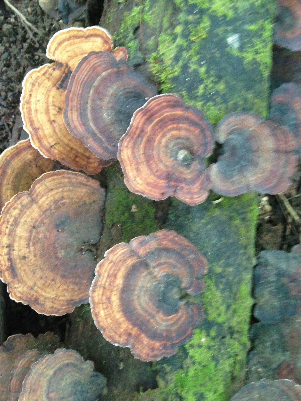
Fungi - Mossman Gorge (not everything was green!)

The Croc(odile) tour is operated by a very swift talking Martin. He has the most amazing memory for names I have ever come across. As per usual I didn’t book, instead just fronting up wanting to get on a tour. Luck was on my side as Martin suggested I pay my dues, and book-in for the 11:30am tour. But because we were there early, maybe he could get me on the 10:45 am tour, “just hang around”. So, we did. Next minute call comes “Jenny, you’re in. A couple hasn’t caught the ferry across (Daintree River), therefore will not arrive in time”. 
Off we ambled to the solar-panelled-electric-motored boat. Boarding with another 20 people left us plenty of room to move around – if absolutely necessary. (The boat didn’t respond well when everyone went to one side to see the crocodiles). On close inspection we sighted Dusty, Skuta, Scar-face and Crow, plus a couple of other little crocs (2’) without names. Dusty the female will be the damsel fought over by Crow (newcomer) and Scar-face for breeding this year.
Crow - the outsider
Skuta (male) is a little younger and won’t contend in the coming season. The guide did say that the smaller ones may not make it to adulthood, instead becoming victims themselves to the larger crocs. Because of the recent floods in February, the Daintree River croc eggs didn’t survive at all; there will be now new crocs this year. I actually felt sorry for these fearsome prehistoric creatures. Their attrition rate is at massive propositions. From all the eggs they produce only half a crocodile will make it to adulthood per season. Therefore, out of two nests one croc will survive. It takes 10 years to grow to 1 metre. The old male crocs we saw were estimated to be about 60 years old. Females stop growing at a certain age, whereas the males will continue to grow till the end of their life. 
After our wonderful few days, we made one more trip down south to Cairns before deciding to head up to the tableland and west for a few days. Final farewells to hubby’s sisters and our son were made. We will catch up again, in a few weeks.
Up in the tablelands we headed towards Chillagoe. A tiny town on the Burke Development Road which once gained its notoriety from… you guessed it mining!  Copper, gold, lead, zinc, tin – you name it, they have it. Miners flocked to this area at the turn of the century to make their fame and fortune (again). This time they came with their wheelbarrows. Full of all their worldly goods and chattels; corrugated tin for homes, kettles, pots and pans, with mother carrying baby, bringing up the rear.
Wheelbarrow man - Chillagoe
To celebrate this historic feat each year they have a ‘Wheelbarrow Race’ from Mareeba, over three days. Teams of ten run with barrow for 15 seconds, then swap with the next person. A bus accompanies each team for the participants to ride in while not running. All teams have to raise money for local charities of their choice, this being the main reason for the race.
Chillagoe itself is a tiny town with basic infrastructure; police station, coffee shop, 2 hotels, general store and hardware shop. One quaint aspect of the General Store is the different and variant items for sale; Karaoke machine, electronic microphone and the one that took hubby’s fancy – chocolate fountain!  
We stayed in a free-park behind the Cockatoo Hotel, where Rhonda and Rob looked after us exceptionally well. Nice cold beer (for hubby), good wine (for me) and two nights off cooking preferring to spend our money in the pub. It was also a good central location to take off from and see the sights. And sights – there are quite a few. 
The old smelters, with interpretive signs describing the incredible mining past is a must see. John Moffatt a mining entrepreneur spent almost half a million pounds setting up the mine in Chillagoe. William Atherton became the owner of Chillagoe Station supplying the miners all the meat. Both men were pioneers in their fields. Although the smelter is fenced off for OH&S reasons (asbestos etc), the vantage points around it give you fantastic views over all aspects. This once thriving place once employed 1000 workers.
The old smelter

A few details of the mines operations
Once again though this type of mining was very expensive and for little profit, ceasing operation not long after WW2.
The mining industry continues in the area to this day with the main product being zinc. Mined here, then transported via truck to Townsville Port and exported overseas, it never ceases to amaze me how much of our land is being taken off our shores. We saw several trucks with 3 road trains heading out of town each day. 
The other product of interest mined here is marble. Big white blocks dot the road into Chillagoe. All placed in a circle, apparently to prevent the cattle falling into the mine they have been dug from. There is very little activity with this mining at present, as the marble industry itself is extremely slow. The final product also quite expensive and with cheaper look-a-likes around, these blocks lie in the place where they were dug.    
I must admit the bird life around this place is exceptional. Many varieties inhabit the many trees and waterholes: Apostle birds, galahs, black cockatoos, corella, ibis, blue-faced honeyeaters, magpie, mudlarks, bustards, guinea fowl and about 8 peacocks. It really was a twitcher’s paradise.
Blue-headed Honeyeater

The other aspect we discovered, in our few days here, were the amazing rock formations; including the caves.  We booked a tour to the Trezkinn cave (under advice from the National Parks lady). Proceeding up many stairs we reached the summit of the cave entrance. On reaching the summit, you guessed it, we descended via ladders and stainless-steel handles into the cave (300 steps). Due to school holidays we had some children with us. These little people saved my dignity by slowing down the process of climbing down the ladders, then back up. I had to wait, which was wonderful for my already compromised lungs. I didn’t look like the old lady who couldn’t climb stairs (much!).
The cave itself was wonderous, with colourful stalactites and stalagmites of various form and shape. Shawl, candelabra, column, sideways, some even looking like prehistoric monsters. But I certainly wouldn’t want to be trapped in here as the inhabitants consist of bats, snakes, spiders, and cockroaches (the cleaning machines of the cave). 
Candelabra style cave - Trezkinn

Prehistoric monster? - Trezkinn Cave

Following our adventures in the cave we walked to the ‘Balancing Rock’, a natural wonder of limestone rock situated on a smaller rock ‘balancing’ precariously.  Continuing our tour around town we paid our respects at the cemetery discovering the final resting place of William Atherton and his wife (original owner of Chillagoe Station). This cemetery is very well maintained with all persons remains identified with date of birth, death, gender and occupation on death. As you might imagine, many of them mining deaths from the early 1900’s.
The weir was also extremely pretty, with paperbark trees lining the banks. Locals and visitors alike use this waterhole as a cooling-down place. A great place at sunset to see all the birdlife according to the locals. 
Balancing Rock

The last of our discovery was to check the legendary ‘Ford Museum’ run by the just as infamous ‘Tom Prior’. Tom, now 80 years old, runs his museum most days. Tom is well known in the area as a long-standing resident. His father was the mailman for many years and Tom himself, carting goods (especially fuel) to many of the far-flung destinations. His Ford trucks were instrumental in covering much of the rough tracks once deemed impassable to other users. He still drives his 1946 V8 Super Deluxe coupe ute around town.
As much as we are Holden people, we thought it might be worth a look around at all the historic equipment Tom had on offer. Unfortunately, the day we called Tom wasn’t home.  Oh well, just as well perhaps – at least we didn’t have to put up with all that Ford hype! 
We are back on the road again. This time we are closing in on our companions travelling to the Cape. I promise next time my next post will be from the Cape somewhere, but in the meantime I hope you have enjoyed our side-trek as much as we have.