Monday, 22 July 2019

Part 6

Part 6
“I think we might make a trip out to Portland Roads” I say, standing on the intersection that can lead either to the ‘Tip’, back to Cairns or out to Portland Roads and Lockhart River. “It sounds an interesting place, with quite a bit of WW2 history. Might we worth a look”. We are already very familiar to gravel, dust and corrugations therefore nothing we haven’t seen before!
After picking-up with our new travelling companions, we did our last stock-up of good, fuel and water before ascending North for our intrepid journey to reach the top of Australia. Early days into the trip had been very uneventful. The road was bitumen and not as we had expected; more climbing the Great Divide than anticipated.
Following the mountains for most of the way, with the occasional flat savannah to break the scenery. We free camped the first night out; in a gravel pit (as you do), beside the road. An hour into our quite little hideaway and we see two more vans making their way towards us. “There goes our peace and serenity” one fellow traveller commented.  Although it was not what we really wanted, the company was good, with chat among the visitors and ourselves robust. 
The following night we stayed at Musgrave, a small outpost from a bygone era of the overland telegraph (Qld).  This old station has been turned into a place of respite for weary and dusty travellers. A small café/restaurant made a pleasant reprieve from the cooking. The hot showers were wonderful taking the layers of red dirt from under the fingernails, skin and the hair. Following our night of ‘luxury’ we were on our way again. 
I’ll admit here, so far into this journey, beside the scenery I was disappointed in our trek to the top. Beside the mountains and roller-coaster roads, it was…well boring to a certain degree. The road was bitumen a lot of the way, with patches of gravel to make sure you were awake, but nothing out of the ordinary. 
When other travellers from our pervious attempt went to the ‘top’, some of them felt cheated in some way. They felt for various reasons, they had rushed the trip, missing side-trips along the way. Their recommendation to us was “make sure you do it right. See everything you can”. I was beginning to think they were right; we needed a diversion hence the intersection to Portland Roads.
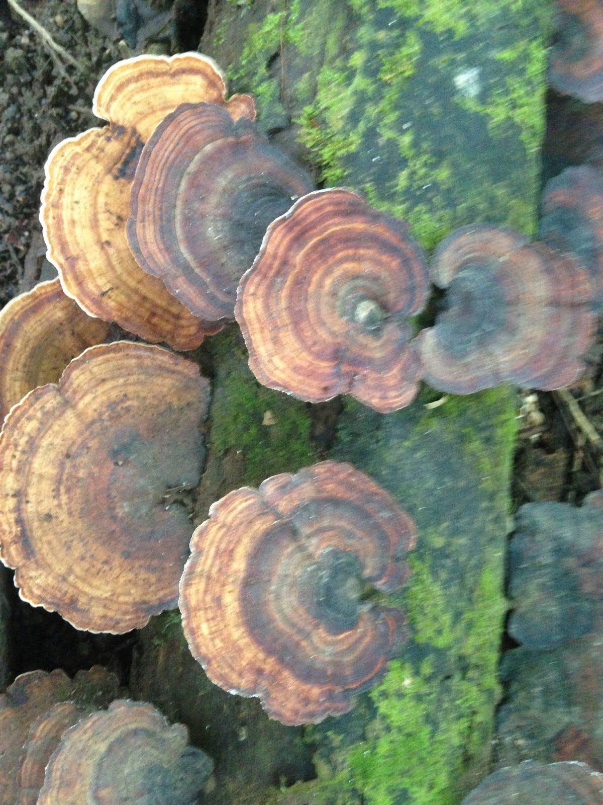
As we trundled down the roads, we really had no concept of what we were to encounter. The first part of the track lent itself to some burn-off of vegetation, making the termite hills standout, like ‘boot-hill’, in this black environment. There are various types of anthills; the ‘standard’ red dirt, to the exotic type of the magnetic. These ants build their empires of dirt in a north/south direction. This type of hill is used in swampy areas to alleviate heat stress in the nest. In the morning the ants migrate to the west, evenings to the east, for the cooler area. I guess you could say environmentally aware ants!
Once through the burn off area we encountered our first water crossing on the road. A mild stream a few metres wide, with good rock bottom. After many dips and twists we finally arrived at the Wenlock River.
After an easy entry we crossed the river following the concrete causeway underneath. The exit required a bit more navigation, as the slippery conditions from the water we carry through, and a couple of bumps made the Totoya and BT rock and roll. 
Our female traveller is not an adventure junkie in any sense of the word, so her initiation to true 4WD on this trip was just activated. 
After crossing the Wenlock, we decided to traverse a few kilometres to a camp site run by the local indigenous people. A campsite with plenty of space, a toilet and ‘donkey’ shower greeted us.  On arriving we were welcomed by a lovely lady who, along with a party of at least 6 others had been here for the past 3 weeks. She explained the ‘donkey’. The shower is hot, as long as the water is heated. To heat the water, create a fire in the stove. When you finish your shower, make sure you throw another piece of wood on the fire as you leave.
After these short instructions she then proceeded to tell us why they had been here three weeks. The party is an archaeological team, with all members doing their PhD. Even the Professor was present, assessing their skills along the way. They apparently did find some artefacts of significance here, which the Elder of the people was very excited about. Much of the history of his place had been either destroyed or hidden with overgrowth of vegetation, over the past 150 years. 
We did speak to her about the road into Portland Roads and Chilli Beach (Iron Range NP). She informed us the road was reasonably good, with occasional water crossings, and patches of bitumen. The Café at Portland Roads had a good reputation, but was closed on her venture yesterday! Lockhart River was quite a shock to her, but was the only place you could fill for fuel and supplies. 
Next morning, we were up bright and early ready for our new escapade. But not before my dear hubby had decorated the next-door caravan with streamers and balloons. It was female traveller’s birthday. Happy birthday V! Pancakes were on the breakfast menu today to add to the celebratory mood. 

After the camp lady had told us it would only take around 90 minutes to get into Portland Roads, we didn’t understand how she could be so wrong in her timing. It turned out to be a 4-hour one-way trip after many water crossings, Pascoe River included. The last of the journey included so many potholes, trying to dodge them was almost a waste of time. There were places where 4WD was absolutely necessary with some of the entries or exit to the crossings horrendous. White-knuckle fever present around most corners or dips. We travelled slowly until the bitumen section where a bit more speed was warranted. No damage to either van or car was our aim. We still needed to return! And this was a very remote part of the Cape, let alone Australia. 
Travelling through the last of the rainforest we came upon Portland Roads. What an oasis in this forbidden part of the country!  Manicured laws, swaying palm trees and newly varnished park seating. The surrounding mountains of Portland Roads added to its mystic. The ocean lay in front of us with opening arms. Alas, no swimming due to crocodiles! The old ruin of the port jetty could only be made out in the distance. A few broken wooden piles and iron nails all that remain. Once a thriving military base, Portland Roads was home to many air force and army personnel, being the main port for the FNQ detachments. Japanese subs patrolled the inner reef, destroying many of our allied ships in this area. Who knew?
The café was a quaint place set halfway up the mountain with a view over the cove and water. We spoke to the lady in charge and booked in for the evening meal. Pre-booking Male and Female traveller had the seafood platter. I, the garlic prawns with fettucine, hubby – fish and chips.  A wonderful way to celebrate V’s birthday. One I’m sure she will remember for a very long time.
Remote location, starry night, good company (I hope) and a romantic husband to boot. What more could a girl ask for? That night though we did have to free camp. Shhh! Don’t tell anyone. You are supposed to book for the NP, but seriously how would you know what the place was like unless you check it out first! Next morning, we went back to the entry to Portland Road to take a picture of the van, proving we did actually go there. After talking with one of the Shire Council workers he said “we were the first caravans we had seen in 2 years to make it in”! 

On waking the next morning, we wound our way into Chilli Beach. White quartz sand, coconut palm trees and a stiff sou-easterly wind blowing, greeted us on this beach. Two intrepid sailors in wind-assisted kayaks were launching off the beach, apparently heading to the ‘tip’. Their journey commenced at Townsville, we were told and were completing this in favour of ‘Mates Hero’s’ Charity. This Charity was set up to highlight the plight of return service people and their ongoing mental health issues.
After a quick look around, it was back into vehicles and onto Lockhart River where we could refuel as we were now almost empty. On the way into Lockhart River we passed the Gordon Airbase, once used by American Bombers. It remains an airfield to this day and I’m sure the remote community is thankful for its presence. While we were wandering around looking at the military images placed there in recognition of past service, a RFDS plane was about to take off. Who with?  Don’t know details but I hope they were ok and I’m glad it wasn’t me! 
Into Lockhart River finally and filled with one tank of fuel. All prior paid via the EFTPOS machine before the pump would turn on.  (As I write at present the whole of the Cape York Peninsula is off-line. We have no phone reception; no EFTPOS and all monetary transactions are in CASH! So much for the cashless society they predict in the future).
While waiting to refuel, some of the local indigenous children were running around pushing a Toyota Ute through the service-station. One child about 12-13years old was in the driver’s seat, while the rest of the children pushed the car down the hill to roll-start it. Yes, it did go and yes, the young person did drive it around town. So much for Community living.
Eventually after our refuelling we then headed out of town (after getting directions from a local) toward the coast – Quintile Beach.
Another pretty part of the world, with many fishing dinghy’s spread along the beach in various states of repair.  A quick look around, but time was fast running out. But not before finding what we thought was the true Lockhart River. (On looking at maps after the event, we are still not sure if it was, or just another tributary).
It was now time to return to our campsite from the previous day – back to where the archaeologists had been.  Return trip only took 3 hours. Obviously, we felt more confident in our drive this time. 
Returning to camp, we parked in the same place as previous. We also had to share or camp area with a marauding group of Oztrekers. A 4WD group had set up camp over the other side from us, using all the hot water… in fact all the water, until the Ranger came along and refilled the tanks from the Wenlock River. 
The date was now the 20thJuly. A significant date in our history as it turns out. The day man landed on the moon. To celebrate this 50thanniversary hubby brought out the projector, computer, screen and sound system to give a private screening of ‘The Dish’. To be honest re-watching this movie, on this auspicious day gave me goose-bumps. And right-on cue, as Neil Armstrong said ‘one step for mankind’ the (almost) full moon came up behind the vans! Perfect timing or what?
What a wonderful day to end a fun filled couple of days. Tomorrow we head for Wiepa.   


Friday, 12 July 2019

Part 5

Well, I was wrong. We haven’t yet made the Cape, instead taking a few side-steps along the way from Cairns.
Cairns has had an unusually wet ‘dry’ season. It has rained nearly every day. After seeing our son and catching up with two of hubby’s sisters, we decided to get out of town. 
Heading north we drove in to see Palm Cove, Yorkey’s Beach and a couple of other major tourist places. Unfortunately, they all look the same; cafes, bars and high-end shopping. Nothing of great interest to me!
We followed the coast most of the way with very pretty vistas overlooking the ocean, before stretching out on the sugar cane flats of Mossman. A short stop at Port Douglas (once again, resort style living) for lunch.
Mossman Gorge was a short trip off the main road where the two sisters checked out the availability of caravan parking.  The idea was for them to check out the location and report back to us. After waiting a respectable amount of time, we sent a text message. No response. I thought maybe reception was a bit dodgy so waited some more. As some may know, patience is not my virtue and when no reply was forthcoming, we decided to wander on to find a camp for the next few nights. 
Somewhere down the track, the message came through ‘all good for vans’.  Sorry we were already heading out of town. We will come back at a later date. 
I will say here I am also an impromptu person, but on this occasion (due to Qld school holidays) I actually rang a few van parks in close proximity looking for vacancies. The first 2 ‘no vacancy’. On the third try, ‘yes plenty of space (unpowered). First in gets to pick where they park’. I liked the attitude and loved the park. Fifty metres from the beach, green grass, large trees but enough sun to charge the battery. Perfect! Call it serendipitous; with all other parks full and this piece of heaven - Wonga Beach.
Wong Beach

Our view from the van - Wonga Beach
We booked in for three nights but extended an extra day, even though the mournful scream from the Curlews were noisy during the night. From here it was easy to discover Mossman Gorge one day, Crocodile boat tours the next. Walking on a deserted beach, reading books and generally ‘chilling-out’ created the perfect respite. We didn’t cross the Daintree River this way, leaving Cape Tribulation and the likes for another trip down from Cooktown.
Mossman Gorge was very pretty and is the southern boundary for the Daintree Heritage area, living up to its reputation. Pristine wilderness with vines, water-ways, large trees and ferns of all description. Green, green and more green!
Fungi - Mossman Gorge (not everything was green!)

The Croc(odile) tour is operated by a very swift talking Martin. He has the most amazing memory for names I have ever come across. As per usual I didn’t book, instead just fronting up wanting to get on a tour. Luck was on my side as Martin suggested I pay my dues, and book-in for the 11:30am tour. But because we were there early, maybe he could get me on the 10:45 am tour, “just hang around”. So, we did. Next minute call comes “Jenny, you’re in. A couple hasn’t caught the ferry across (Daintree River), therefore will not arrive in time”. 
Off we ambled to the solar-panelled-electric-motored boat. Boarding with another 20 people left us plenty of room to move around – if absolutely necessary. (The boat didn’t respond well when everyone went to one side to see the crocodiles). On close inspection we sighted Dusty, Skuta, Scar-face and Crow, plus a couple of other little crocs (2’) without names. Dusty the female will be the damsel fought over by Crow (newcomer) and Scar-face for breeding this year.
Crow - the outsider
Skuta (male) is a little younger and won’t contend in the coming season. The guide did say that the smaller ones may not make it to adulthood, instead becoming victims themselves to the larger crocs. Because of the recent floods in February, the Daintree River croc eggs didn’t survive at all; there will be now new crocs this year. I actually felt sorry for these fearsome prehistoric creatures. Their attrition rate is at massive propositions. From all the eggs they produce only half a crocodile will make it to adulthood per season. Therefore, out of two nests one croc will survive. It takes 10 years to grow to 1 metre. The old male crocs we saw were estimated to be about 60 years old. Females stop growing at a certain age, whereas the males will continue to grow till the end of their life. 
After our wonderful few days, we made one more trip down south to Cairns before deciding to head up to the tableland and west for a few days. Final farewells to hubby’s sisters and our son were made. We will catch up again, in a few weeks.
Up in the tablelands we headed towards Chillagoe. A tiny town on the Burke Development Road which once gained its notoriety from… you guessed it mining!  Copper, gold, lead, zinc, tin – you name it, they have it. Miners flocked to this area at the turn of the century to make their fame and fortune (again). This time they came with their wheelbarrows. Full of all their worldly goods and chattels; corrugated tin for homes, kettles, pots and pans, with mother carrying baby, bringing up the rear.
Wheelbarrow man - Chillagoe
To celebrate this historic feat each year they have a ‘Wheelbarrow Race’ from Mareeba, over three days. Teams of ten run with barrow for 15 seconds, then swap with the next person. A bus accompanies each team for the participants to ride in while not running. All teams have to raise money for local charities of their choice, this being the main reason for the race.
Chillagoe itself is a tiny town with basic infrastructure; police station, coffee shop, 2 hotels, general store and hardware shop. One quaint aspect of the General Store is the different and variant items for sale; Karaoke machine, electronic microphone and the one that took hubby’s fancy – chocolate fountain!  
We stayed in a free-park behind the Cockatoo Hotel, where Rhonda and Rob looked after us exceptionally well. Nice cold beer (for hubby), good wine (for me) and two nights off cooking preferring to spend our money in the pub. It was also a good central location to take off from and see the sights. And sights – there are quite a few. 
The old smelters, with interpretive signs describing the incredible mining past is a must see. John Moffatt a mining entrepreneur spent almost half a million pounds setting up the mine in Chillagoe. William Atherton became the owner of Chillagoe Station supplying the miners all the meat. Both men were pioneers in their fields. Although the smelter is fenced off for OH&S reasons (asbestos etc), the vantage points around it give you fantastic views over all aspects. This once thriving place once employed 1000 workers.
The old smelter

A few details of the mines operations
Once again though this type of mining was very expensive and for little profit, ceasing operation not long after WW2.
The mining industry continues in the area to this day with the main product being zinc. Mined here, then transported via truck to Townsville Port and exported overseas, it never ceases to amaze me how much of our land is being taken off our shores. We saw several trucks with 3 road trains heading out of town each day. 
The other product of interest mined here is marble. Big white blocks dot the road into Chillagoe. All placed in a circle, apparently to prevent the cattle falling into the mine they have been dug from. There is very little activity with this mining at present, as the marble industry itself is extremely slow. The final product also quite expensive and with cheaper look-a-likes around, these blocks lie in the place where they were dug.    
I must admit the bird life around this place is exceptional. Many varieties inhabit the many trees and waterholes: Apostle birds, galahs, black cockatoos, corella, ibis, blue-faced honeyeaters, magpie, mudlarks, bustards, guinea fowl and about 8 peacocks. It really was a twitcher’s paradise.
Blue-headed Honeyeater

The other aspect we discovered, in our few days here, were the amazing rock formations; including the caves.  We booked a tour to the Trezkinn cave (under advice from the National Parks lady). Proceeding up many stairs we reached the summit of the cave entrance. On reaching the summit, you guessed it, we descended via ladders and stainless-steel handles into the cave (300 steps). Due to school holidays we had some children with us. These little people saved my dignity by slowing down the process of climbing down the ladders, then back up. I had to wait, which was wonderful for my already compromised lungs. I didn’t look like the old lady who couldn’t climb stairs (much!).
The cave itself was wonderous, with colourful stalactites and stalagmites of various form and shape. Shawl, candelabra, column, sideways, some even looking like prehistoric monsters. But I certainly wouldn’t want to be trapped in here as the inhabitants consist of bats, snakes, spiders, and cockroaches (the cleaning machines of the cave). 
Candelabra style cave - Trezkinn

Prehistoric monster? - Trezkinn Cave

Following our adventures in the cave we walked to the ‘Balancing Rock’, a natural wonder of limestone rock situated on a smaller rock ‘balancing’ precariously.  Continuing our tour around town we paid our respects at the cemetery discovering the final resting place of William Atherton and his wife (original owner of Chillagoe Station). This cemetery is very well maintained with all persons remains identified with date of birth, death, gender and occupation on death. As you might imagine, many of them mining deaths from the early 1900’s.
The weir was also extremely pretty, with paperbark trees lining the banks. Locals and visitors alike use this waterhole as a cooling-down place. A great place at sunset to see all the birdlife according to the locals. 
Balancing Rock

The last of our discovery was to check the legendary ‘Ford Museum’ run by the just as infamous ‘Tom Prior’. Tom, now 80 years old, runs his museum most days. Tom is well known in the area as a long-standing resident. His father was the mailman for many years and Tom himself, carting goods (especially fuel) to many of the far-flung destinations. His Ford trucks were instrumental in covering much of the rough tracks once deemed impassable to other users. He still drives his 1946 V8 Super Deluxe coupe ute around town.
As much as we are Holden people, we thought it might be worth a look around at all the historic equipment Tom had on offer. Unfortunately, the day we called Tom wasn’t home.  Oh well, just as well perhaps – at least we didn’t have to put up with all that Ford hype! 
We are back on the road again. This time we are closing in on our companions travelling to the Cape. I promise next time my next post will be from the Cape somewhere, but in the meantime I hope you have enjoyed our side-trek as much as we have.      

Tuesday, 2 July 2019

Part 4

Part 4
Well, where do I start? What a whirlwind week we have had. Now nestled in the caravan park in Cairns, we have travelled from one end of Qld to the other.
But let me go back a bit to Mt Isa. (My that seems and eternity ago). 
We toured Mt Isa in a small way. Out to have a look at Lake Moondarra; a fresh water lake dammed on the Leichardt River, supplying Mt Isa with its water supply. Very pretty in amongst the rich hills, surrounding the township.
Lake Moondarra - Mt Isa
A bit of a shop to stock up with things and a night out. Wow! What a place our fellow travellers found for us. The Irish Club, complete with tram restaurant, where a pleasant evening was undertaken. I must admit it felt rather strange sitting up in this tram, within the building, eating a meal.
Our tram - Irish Club - Mt Isa
But a few reds and good companionship and we could have been anywhere.

The following day it was time to pack-up and almost say farewell to our comrades for the past two weeks. The road from Mt Isa to Cloncurry is one of the prettiest roads I have ridden over. Rolling rocky hills, with olive green trees lining the gullies; there was always something new around the next corner.   
I said almost, as we did meet up with them one more time in Cloncurry for the, once again, coffee and cake! By this time, they had met up with other friends who were travelling in their direction. We on the otherhand hand now headed north. Saying goodbye in Cloncurry was bittersweet, as we experienced many good times on and off the tracks. But we knew they were in good hands travelling south with their other friends, so bid farewell. Good luck and safe travels C&D, we’ll miss you.
Heading north we made our way up the Savanah Way to the Burke & Wills Roadhouse, Normanton and Karumba. Unfortunately, we only made Normanton this far north. Reports were coming out of Karumba about infections in the water coming from the river, due to dead animals being swept out to sea. These were the dead stock and wildlife drowned from Cyclone Trevor and the major floods that hit Townsville earlier in the year. We saw the best of this major flooding event at Birdsville, but this was the ugly part. I wasn’t enthralled about seeing this at all. We also had reports that few fish were being caught with one fisherman saying it was the worst he had experienced. This was the same fisherman who was losing his toenails and fingernails due to the water quality. After hearing all these horror stories, I thought it prudent to skip Karumba. Maybe next time.
Staying at Normanton overnight we then caught up with my brother, his wife and another couple travelling with them. We have travelled with them to Cairns sharing many a funny story and adventures, especially around Mt Garnet. 
Normanton was a quiet place with its Big Crocodile being the most photographed icon in town.
Krys the Crocodile - Normanton.
The history of Normanton is quite unique. William Norman commanded a ship to try and find Burke and Wills on their trip from south to the north. He didn’t find them, but the river he followed was named in his honour.  (Burke and Wills last camp is located 40kms south west of Normanton. So close, yet so far!). The town which takes his name, became the administrative centre for the Shire of Carpentaria. It was a major port for distribution in Tropical NQ during the gold rush days of 1890’s. Gold was the major export from surrounding areas of Croydon and Georgetown during this time, travelling to Normanton via the Gulflander Train. Nowadays cattle play a major role in the exports from the area. 
The landscape was changing again. Wedgies no longer seen, but Kites still abundant. The open plains were home to great flocks of Brolgas, now the dominant bird. Unfortunately (for us), they are highly camouflaged and take flight when disturbed. Photographing them is a nightmare, never staying still more than a few seconds. 
Tropical shrubs and the occasional palms signify we are in the tropics. There is little evidence left to indicate where the water engulfed the area previously. The occasional fence with wooden debris or an unlucky cow, hooked in it, is all that remains. The grass is now beginning to dry off. Still quite a few cattle to be seen, but they look in poor condition. 
Continuing on our journey and we stopped beside the Gilbert River one night in a free camp. We set up our vans in a ‘U’ shape with fire in the middle. All was going well. Cooking was in full swing when another car and van pulled in to the site. By this stage it was dark and we see someone in silhouette of his headlights looking under his car. 
Hubby says “I bet he has hit a kangaroo. What sort of D.H. travels out here at night?” 
Next minute this male figure starts walking to our camp. “Hit a roo” says the new-comer. “Put one of my lights out. Just replaced it the other day from the same thing”. (Wouldn’t you think he might have learned his lesson?) My brother then in his ‘merry way’ says “What’s your name mate? Why don’t you pull your van over here and make a square; plenty of room”.  
“Thanks pall. My name is Frank.” 
Now to put it delicately ‘Frank’ turned out to be a rather unique individual. Strange, doesn’t do him justice. Oh yes, he is quite harmless (I think) but insisted that ‘he chased aliens for a hobby’! He also suggested that the Bible is changing its words. (I’m sure our friend Rob would have had a great time with Frank).
Next morning, it was suggested that Frank actually had a captured alien in his big box on the back of his car and was taking it to a secret base. I told you he was unique.
Finally, Frank left our presence (thankfully without any alien escaping), before heading towards Innisfail. Safe travels Frank! As for my brother inviting anyone else to join us – NO!!!
Before any more incidents we arrived in Mt Garnet at the home of one of brother’s friends. He and his wife had a fabulous area at the back of their house which catered for all three vans and cars. A nice grassy patch, with great company was home for the next few days.
As we arrived early in the day the afternoon saw us take in the local sights. Unhooking two of the vans allowed us all to be transported to a secret spot near Innot Hot Springs. Through a station gate and down some 4WD tracks, the occasional view through the trees brings us to an old tin dredge left over from 1995. This Heritage Listed Dredge, (Nettle Creek Tin Dredge) remains in position from where it worked all those years ago. 
Nettle Creek Tin Dredge remains

Now falling into disrepair, it is a reminder of a once vibrant mining industry in the past not that long ago.
Following this discovery, we then ventured back to Mt Garnet and up the large hill to the tower and lookout. Once again 4WD, was required on this rather steep and guttered track. The view at the top was amazing. Not only could you see the lake that keeps Mt Garnet in fresh water, but also on the other side, the current zinc mine in full action. Loaders, side-loading trucks and dust. As it turned out this little taste of the area’s mining history was just a starter. 
Under direction of our hosts, the following day we set out to see the natural sights of the area. As the day was inclement, our trip was curtailed slightly. We left the sights of the main crater for another day due to being drenched in the rain forest. Instead we had a lovely Devonshire Tea with jam scones and cappuccino in the old Lake Barrine tearooms. The tearooms overlooked the beautiful crater lake with its pristine water. Not a bad day in the rain!
Our group at the Tea Rooms

Curtain Fig
Next, we took in the sights of Lake Eacham (another crater lake), before heading into Yungaburra. This quaint little village is nestled on the edge of the Atherton Tablelands. The old hotel is in renovation to try and preserve its rich history of early Australian architecture. Following lunch at the hotel we traversed to Lake Tinaroo (a man-made dam) and the Curtain Fig Tree. This magnificent tree is covered by the vast roots system. 15mt of the strangler fig reaching to the ground.  

The day was getting late and our final stop for the day was at Herberton. This is the oldest town in the Tablelands with tin mining its main stay. Now I’m not really a museum type, but this one was quite different, with working small replicas on the mining operations. Press a button and everything came to life. Conveyers, tipping devices and crushers. As we were very late getting here (4:00pm), we only had limited to time to scour the place. The volunteer in-charge was wonderful, allowing us a 10-minute browse, while he counted the money for the day. An informative fellow and very proud of the town’s mining past, we thank him greatly.    
Arriving back home, we were exhausted from a packed day of sightseeing. But we were to do it all again tomorrow in different areas.
Sunday dawned and we headed out in our 4WD’s along the Silver Valley road. Twisting and turning around gravel tracks we finally came upon a gem of a place called Irvinebank. Again, a mining history with gold being the main find here. A light lunch at the hotel and more exploring. This time the boys found a wonderous place with two amazing men – Brian and Alan. 
Brian's machinery (part of).

Brian had retired four years ago at the age of 70yrs and needed a hobby. His hobby is now on show for everyone who is interested. Old compressor, cars, Blitz trucks, pumps – all in working order. Brian can’t resist getting everything to work and is a proud owner to show off his hobby to anyone who is interested. Alan is the quiet one and is the ‘designer’ behind Brian. As Alan put it “Brian makes things go. I show them off”. Apparently when they met, Brian had all his ‘stuff’ on the floor where no-one could see it. Alan built walls from mesh and displayed all the goods in categories for all to see. The place is truly inspirational for any mechanic, engineer or person just interested in old machinery and other nick-knacks. 
After much time here, we then had to trek home. But before we left hubby vowed, we will be back for a longer time, next time. I won’t mind as it is a beautiful little village, with a big heart and big past. 
With the past two days crammed with all the history, mining, natural wonders and interesting places I felt overwhelmed. My head was spinning with information and felt I had been here for more than two days. Thanks J&J for your hospitality and informative tour of your area. We will come back one day – promise!
Well, we are now in Cairns where we have split from brother and compatriots. We have caught up with our son who lives here and now find more relatives (hubby’s) are on their way. We are in a bit of a holding position at present while waiting for the next tourists to join us when we head up to Cape York. In the meantime, we will catch-up with some friends in the Daintree, while exploring this tropical north. 
Stay tuned, as the next post will be from somewhere in the Cape area.        


Sunday, 23 June 2019

Part 3

Part 3
Well hello again. This time we are in sunny Mt Isa. Although it is sunny it is also unseasonably cool at present with temperatures only reaching about 21C. The diesel heater has been working overtime in the mornings with the conditions plummeting to a low of 0-4C. I haven’t actually seen any frost yet, but that might have something to do with the time we arise from bed!
Travelling from Birdsville we headed north toward Bedourie. Due to the recent flooding in the channel country, roads have been damaged. A detour out towards Lake Machattie made for some scenic driving as we traversed the area around the lake, through the typical gibber and into some red sand dunes. The dunes once again became the barrier between some water reaching areas, while missing others.
Right side water - Left side no water.
Farming in this country is very haphazard with water distribution. The occasional cow or two could be seen, but very little other life form. 
Finally, we reached the main road back into Bedourie where upon arrival we see the vegetable truck we left in Birdsville. What? How did he beat us into town when he certainly didn’t go past us?  It was bewildering, but discovered from the local Hotel owner, local traffic has right of way over the road where we had to detour. 
After the mandatory drink at the old establishment ( Bedourie hotel), we made our way out the road to find a campsite.
Bedourie Hotel
A few false starts and finally we came to a good stand of gum trees along a creek, where a pull-off was enough to get the vans out of sight and settle for the night. The loneliness of the night was quickly shattered with the jovial company we keep. With the campfire lit, it was time for a few drinks, some nibbles and some funny anecdotes about our day. And believe me there were some funny stories. Nothing repeatable on a blog, but yes, funny!    
The next morning, we joined the track again traveling into Min Min country, towards Boulia.  
The road was now all bitumen, so the going was relatively easy, except when oncoming traffic needed to pass. The road is only one car wide. To let other vehicle pass you have to move off to the gravel shoulder. I guess we should be appreciative of the QLD government in putting these roads in, but an extra 6’ either side would make a great deal of difference to broken windows and dinted cars and vans. You don’t realise how big this state is until Bob Katter's posters pop-up in Boulia. This politician covers an extremely large area from Cairns on the coast, to the Northern Territory border. The population in this area is sparse, so I guess we will accept Mr Katter’s effort for a road!
Into Boulia we called and headed straight to Information Centre. From here we obtained some tickets for the ‘Min Min Outback Encounter’, plus the Stone Cottage Museum. We had already seen the experience ourselves, but for our fellow travellers booked the round trip. Once again walking was required to the Stone Cottage.
Original house - Stone Cottage - Boulia
Once again male traveller complained about walking. I find humans strange creatures at times, as this male traveller complains with any walk we take. Yet he will walk for kms around old machinery, or down the road to discover what might be there. This apparently isn’t called a walk! 
Into the Stone Cottage we went, where we discovered the original house of Boulia (stone cottage), all the traditional equipment used in the 1800-1900s including a charcoal meat safe. 
The fellas went off to discover …more old machinery! The girls wandered the place discovering marine mammals from a time when dinosaurs reigned supreme. Big fish with sharp teeth enthralled and amazed us. To think these creatures roamed the sea 100 million years ago and to be discovered in this area, is staggering.
Prehistoric fish from Inland Sea 100 million years ago
The infamous inland sea is responsible for these large beasts and according to the manager of the place “more is out there somewhere!”
Moon rocks at the bottom of the tree
Another fascinating aspect were the ‘moon rocks’ displayed around the museum. Once again according to the Manager, these can be found out on the Winton Road where the road works have recently been constructed.  These rocks are almost uniquely round and were formed (you guessed it) back with the dinosaurs. The theory is that at the nucleus of these rocks is a fossil. To buy one would set you back over $100. 
Better to go and see what you can find on the road, I think!
We were on a tight timeline for this tour and needed to get back to the Information Centre for the next show. In between we had to pull the fellows away from their machine obsession. They even went as far as climbing on some of the old trucks and postulating theories about how they worked. Seriously, how many old bits can you ‘ooh and aah’ about?
Old relics - and fellas!

Yes, more walking back down the street (all of 8 minutes each way) and we tried to push lunch in before our show. And push is turned out to be. After ordering our meal at the hotel we waited and waited. Time was ticking away and nothing was happening.  10 minutes before our show was to start, the meal arrived. I have never eaten a chicken burger as quickly as this one and was sure indigestion would be the consequence. Hubby decided to eat his chips and asked for a take-away for his steak sandwich (wise move!).  Male traveller made a quick dive on his steak sandwich, chewing his last morsel as he sat down just as the introduction to the show began at 1:00pm. Female traveller made the right decision ordering a pie. No indigestion there!
The animated show was once again brilliant, with stories about the Min Min lights and its mysterious appearances in these far-flung areas of Australian. Even though we didn’t actually see a Min Min light, the myth will forever stay in our minds.
A quick shop for milk, bread and chocolate and back on the road. This time the channel country was making way for the more treed acres. Spinifex was starting to dominate and even rocky outcrops were seen on the horizon. Cattle were more prevalent and road-kill appeared more frequently than anywhere previously travelled. Kites, Crows and the magnificent Wedgie (Wedge-Tailed Eagles) were devouring the cadavers of cow and kangaroo on a regular basis.
Wedgie leaving his lunch 
The Wedgie reigns in this harsh landscape, taking precedence in the bird hierarchy. Slow to move from the road I insisted we slow right down. This allowed me the perfect picture, from the comfort of the car. 
The last leg of the day ended in Djarra, a small community 150kms from Mt Isa. Not much here but a Hotel, Roadhouse (selling everything), school and hospital. A lovely free, grassed camp with campfire for the night and we couldn’t ask for more. The Corella's were an extra benefit. A new amenities block under construction is almost complete which will set this area up for more good camping for tired tourist’s in the future. 
Coming into Mt Isa. Scenary is now changing from the gibber and channel country

Now I’ll say here, at times our travelling companions have an issue with their UHF radio. For some unbeknown reason the microphone comes on automatically, but they are unaware of it. We in the other car hear snippets of conversations; a bit like being half-a-fly on the wall! All of a sudden travelling down one of the roads, the microphone comes on and we hear female traveller hysterically laughing. We think whatever was said must be hilarious, but have no hint of what it is. Parking for the night female traveller comes to our van. “You’ll never guess what happened” she says. “I picked up a Women’s Weekly back at Boulia, and read the horoscopes for both of us. Mine is pretty good, but Male traveller’s is spot-on” she says laughingly. She proceeds to read it to us and we can’t help but ‘crack-up’ about the content. It is hilarious! Especially for a man who has an aversion to recycled food! I’ll leave it at that, just in case of embarrassment (what happens on camp, stays on camp!).
We have now arrived in Mt Isa, where the smelter smoke dominates the city-scape. An interesting mining town for zinc, silver and copper (originally). No doubt we will discover more about it all tomorrow. Till then…            


Thursday, 20 June 2019

Part 2

You may be wondering why a massive first part to our adventure and a rather shorter version now? Well that's what happens when you forget your password for Google and Blogger and need to reset!
To continue our story...
On our way back from Muloorina, we came upon some unusual stainless steel contraptions normally found on a truck. It appears these things have fallen off the truck on its way either, in or out of the station. No doubt the truckie who lost them would be most put out when the time came to unload. They apparently (according to hubby) are used to put the stabilising legs down when disconnecting a trailer.
Well our good deed for the day was to pick these up and transport them into the Police Station at Marree. As it turns out this was fortuitous as on asking the police lady as to the opening of Birdsville track, she informed us "Anything under a semi-trailer is able to go through to Birdsville". Whahoo! Just the news we wanted to hear. The signs still are saying 4WD only and under 3 tonne, but I prefer the Marree Police policy.
After picking up a few essentials - bread, milk, vanilla slices (other travellers) it was onto the track. I was a little excited, as this was the only track I had yet to travel in this part of the world. Oddnadatta - tick! Strezlecki - tick! Birdsville now the last challenge.
The road although rough, was still in relatively good condition. Very few corrugations, patches of stone and some clay. Throw in the odd wet patch or river crossing and all was making for an interesting drive. It wasn't long before the gibber plains took over the entire landscape. The shimmering rocks made for wonderful mirages. It was easy to think how the old explorers would have been caught out many times when first pioneering this land.
The occasional sand dune was driven over; mostly of the grey type. Red dirt still a while away closer to Birdsville. The land was dry and dusty though with little evidence of rain for years. We were yet to reach the channel country and its wondrous floodplains.
Finally we made our camp that night halfway along the track at a place called Mungerannie. A quaint hotel in the middle of nowhere, with the owners just as excenttric. A very substantial meal and a few red wines (or beers) and it was time to head to bed. We were crooned with Dingo howling for the night. The outback lullaby.
Our male traveler was in his element here as he has a great knowledge and enthusiasm for the old postman Tom Kruse. Even Tom's old
truck was here in the yard, which made both men swoon.
Next day, onto Birdsville - only another 300 kms to go. More river crossings, sand dunes and gibber plains and we passed into true channel country. Green grass as high as your knees reached, in between some dunes (but not all). It certainly was a hit-and-miss business this water caper. A slight detour from the regular road via the bottom of a sand dune made for eventful driving. But the lagoons and water still present in the outback made it all worthwhile.
Finally we made it to Birdsville without much mishap. Paul found a nail in his tyre?? with produced a slow leak, but other wise all unscathed.
Well a day of washing, clothes and cars has ensured. We are now
ready to start our next journey to Mt Isa and beyond. A trip to the racecourse, cemetery and tip and we've seen the sights - according to the fellas. At least I had a look at one of the videos playing at the information centre about the Diamantina  Shire and the residents who make up this unique part of the world.
Gibber plains
Until next part - stay tuned.

Outback Adventure 2019

Part 1
The outback has always held a fascination for me. As a child I watched movies such as ‘We of the Never, Never’ and ‘The Overlanders” dreaming of the wilderness of red dessert sand, Mulga scrub and gibber plains. 
I have now travelled quite a few kilometres over this harsh but wonderful landscape and this trip in 2019 is another adventure with a focus on Lake Eyre, the Birdsville Track and Cape York.
Our companions for this trip were novices to the outback laws of travel; lowering tyre pressures, locking out dust and leaving only your footprints. We on the other hand had never travelled with a ‘real’ caravan before, usually only a home-made camper trailer. This camper trailer served us well in the previous years, but time for an upgrade was required. 
We travelled quickly the first few days from our home in Bairnsdale to Mildura. Crossing the Murray River, we diverted at Wentworth, to see the major rivers of our country converge; the Murray and Darling. From here we went to follow the track out to Rufus River on Lake Victoria, but were thwarted in our attempt as previous rain had made our road impassable. An alternative to Renmark was sought.
The backroad to Renmark was in reasonable condition, with only a few splashes of water and mud making for a fun ride. The poor van was now christened with its first red mud. A great deal more was to follow later in our trek. Only a slight sighting of Lake Victoria was seen in the distance before we found ourselves surrounded by grapevines and in South Australia. 
Renmark was our next stop to restock on fruit and veggies. Quarantine measures at the border, insured all new stock was required. 
Following the Murray River to Morgan we then detoured from the main Sturt Highway towards Burra. A moonscape now captured our imagination as we left behind the irrigated citrus and vines. Low saltbush and sandy red dirt were our scene for the next while until the Clare Valley Hills came into view. 
Bypassing Burra, time was now running short in the day. A place to camp next on the itinerary. Terowie an old railway town was now in sight and it was here we pulled up to camp. 

The history on these long-forgotten towns is something to behold and treasure. All our fellow travellers enjoyed the eerie peace this once bustling place produced. The old railway station; the different gauge train tracks used to suit the once thriving wool and grain industries surrounding this town. Even General MacArthur had his moment of fame during WW2, declaring “I shall return” on the railway platform. 
Nothing much happens these days in Terowie besides a fuel station and general store. The main street is very quiet except for the passing tourist and the odd chook walking by!   
Following a cool night and morning we were off again up the track, this time to stop at the revitalised Peterborough. I say revitalised, as a few years back the community got together and obtained a government grant to help tidy their shopfronts and facias. With the transformation the town underwent, it now looks like someone actually wants to live here. The once dreary falling down streetscape gone. The community also went the one step further, providing a service to all RV (Recreation vehicles), with dump point, water and internet facilities.  
Trains again were a big factor in this town’s history. With five different entrances to town and a major shunting yard, it was one of the busiest railway stations in Australia. Over 10,000 people once called this place home; now the population is down to about 1,500. 
Now the thing about caravanning 2019 style is that most of the vans are self-contained; showers and toilet almost the norm. With this modernisation also comes the dreaded emptying of the toilet. This duty is mostly relegated to the men, under complaint of course. 
As it happened our fellow male traveller is a very animated and talkative man. The usual complaining about the toilet was made as he started to unscrew the outlet cap. Placing the cap upon the lip of the dump-point he continued to release the content of the toilet cassette into the cement pit. Meanwhile my husband had already flushed and returned his toilet cassette to its rightful place and was beginning to fill his water tanks. With water hose rolled out, the lady traveller tripped over the hose, almost losing her footing. On this noise, our male traveller turned suddenly and knocked the cap off the lip and into the dump pit. The issue now was how to retrieve it?  The antics that followed should have been on ‘funniest home videos’. It was too deep in the pit to retrieve by arm alone. And let’s face it who really wanted to put their arm in there anyway? Husband then finds two tent poles and slowly manoeuvres them together, like chopsticks inching the cap up. Several attempts later, and finally an arm goes in halfway, the cap is out. They say a picture tells a thousand words, thank goodness I have a camera in my phone to prove this feat! 

After all this high drama it was time to ‘chill’ out with a coffee and cake. As fortuitous as it may seem, such a shop was just over the road from where we were.
The old Capital Picture theatre had a new identity as a café. On entering the old building, we were met with the staircase and signs pointing inwards. The further we proceeded, the further we were amazed at the transformation the old picture theatre had undergone.
Gone were the theatre seats, replaced by sofas and easy chairs. Small tables and chairs inhabited the interior of the place with old memorabilia scouting the outside. Even down to the Blue’s Brothers statue on either side of the stage, with an American Jeep in the corner. 
The coffee was good but the nostalgia even more appealing.    
The day was slipping past and it was onwards toward our next destination – Wilpena Pound. 
Capitol Theatre - Peterborough
This was the true beginning of our outback adventure. Leaving cities behind, we now turned right into the magnificent Flinders Ranges; this ancient landscape is one of nature’s wonders.
Pulling into Wilpena we made our way over to the information centre, before gaining our bearings on the walk into Wilpena and the old Hill’s Homestead. Walking shoes on, bottles of water carried and we were on our way. Much complaining from our male traveller came “What do we need to do this for? Isn’t there a bus? I don’t like this walking caper” and so it went on. To be honest we were under the impression it was only a 5 kms round-trip, but it turned into 8kms. 
Walking up the track we were surrounded by various gum trees, following the stream. The going was easy although it was a slight incline all the way. A few other walking tracks came off our route pointing to many other highlights of the park. Meeting a few other walkers coming back, banter amongst the group became commonplace. Finally, into view came the old homestead.  Interpretive signs explained the history of Wilpena Pound, the European settlement, farming trials and harsh conditions faced by the early pioneers. 
After a short but very steep trek up the rock staircase we reached the platform where we could survey the pound in its entirety. The panorama is amazing from here.
Panorama of Wilkpena Pound
The undergrowth of the pound was quite thick with only a few larger trees. The walls of the pound are sparse of any vegetation but reign with majesty over the entire place. Once the photo was taken it was return to the bottom and back down the trail.
On trekking back down the track, we happened upon a couple sitting on a log. We asked what they were waiting for, thinking they were just resting, when they said they were “waiting for the bus”. Bus? What bus? Our male traveller was very interested as he was still complaining about the walking, even though secretly he had enjoyed the pound and its history. “How much is the bus?” he enquired. “$3.00 round trip, but you need a ticket” was the response.  
“Where do you get a ticket?” male traveller asked.
“Back at the station!”
“Damn! I guess we will have to walk back after all” male traveller said in a dejected way. A further hundred meters along and male traveller says “those lazy sods. They could have walked back. Fancy taking a bus!”
By the time we had returned to the cars and vans, it was time to head out to our camp. So we thought! Being a National Park, we were supposed to book into the camp sites. Trying the internet, we found the sites confusing and not helpful in any way. We resorted to going back into the information centre to try and gain a site through the main office. Unfortunately, like one of my good friends I don’t like standing in line too long. Impatient, yes!  Especially when the couple at the front of the que has been there over half an hour and line is getting larger by the minute. Many people walked out in frustration, including us. But not until we got a glimmer of information to help in our assessment of where to camp. The rain we had encountered a few days beforehand had also swept its way through the ranges and all gravel roads in the park were off limits. Blinman up the road about 50kms was to be our stop for the night. 
Twilight was now encroaching on us, as we hightailed it up the bitumen, trying to enjoy the picturesque scenery on the way but also trying to avoid the numerous kangaroos. I was on the lookout shouting “there’s one (kangaroo). There’s a heap (Kangaroos)” all the way. As it turns out, unbeknown to us, one kangaroo wanted to make a house call with the travellers behind us, colliding with their headlights and ‘bull-bar’. Eventually making it into town we parked behind the hotel and examined the damage to the car. Not too serious, but enough to be annoying. 
We had had enough of walking and kangaroos for the day, going across to the hotel for pizza tea. Hot showers and nice amenities were a pleasant change from the drama of the day.
In the morning we scoured the old ruins of a copper mine which had operated in Blinman until 1920.
Copper Vein - Blinman
Once again it amazes me how the pioneers found these places and the hardships the people of the day went through. After a short time, we travelled down the Parachilna Gorge Rd, passing some magnificent scenery once again before making our way back onto the main road at Parachilna. Now running low on fuel, it was time to take in the sights of Legh Creek and refuel; both car and persons. A short stopover to stock up on a few basic supplies; milk, bread, ice creams and once again on our way. Leigh Creek was built primarily for the coal mine a few kilometres out the road. It now survives, like many of these outback places on tourist dollars. Only a distant picture of the open-cut coal mine is evident with all access denied into the mine. 
Leaving Leigh Creek, we thought we would now start to encounter some outback roads, notorious for gravel, dust and corrugations. To our delight (and some would say sadness) much of this road is now sealed as far north as Marree. Transportation to some very remote places is now accessible by two wheel-drive vehicles. 
Before Marree though, we found (again) the wonderful old ruin township of Farina. One sign said it all “Far-In-A” (Far In Australia), which I believe sums up the place. It is a place off the main road in the middle of nowhere. Initially a pastoral lease, before becoming a railway siding on the Old Ghan it now hosts thousands of tourists to this oasis, due to an innovative group called the ‘Friends of Farina’.  This volunteer group set up in 2009 to help renovate some buildings such as the Underground Bakery plus others. They also open the bakery over the winter months to provide the tourists with freshly cooked treats like pies, pastries and the necessary bread. It was like a magnet for any passers to drop in, look around the old ruins, before devouring the obligatory coffee and cake. 
Farina Campsite - looking down from War Memorial Hill

We pulled up camp and before long checked out the old cemetery which was full of old pioneers and cameleers. The cameleers were all facing Mecca due to their Islamic faith. At the camp, a War Memorial on top of the hill has been established. This is where war personnel from the area have been distinguished for their duties to our country. Other places of interest was the old ‘donkey’, where you need to stoke your fire drum, heating the water before a shower is undertaken. Novel but efficient. 
Only staying one night, it was back on the road to Marree, where a stop ensued. This was to check the old train engines in-situ where they will be housed for their eternity, at the old Marree Station.  
On then to our camp for the night – Muloorina Station 54kms out from Marree. Leaving the bitumen behind, we now made our way on the gravel. The road, recently graded, was still easy going until we reached the final 2.5kms and found the dreaded corrugations. 
The billabong of Muloorina was now in site with its glistening artesian water beckoning. The trees around the billabong are full of birdlife with fish abundant (small) inhabiting this extremely warm water. You can swim in the water as the outlet to the billabong is quite a way upstream and has plenty of time to cool for you to enjoy swimming if wanted. 56C is the temperature at the head of the water as it comes out the pipe. 
Now I said in the beginning that our mission was to see water in Lake Eyre North. Another 46kms up an extremely awful corrugated road is the viewing point for such an occasion. After talking to other campers, we find that the is NO water can be seen on the lake from this vantage point. NO WATER!!!! What is all the media talking about the lake being full? Very disappointing. Time to re-evaluate our trip. What now? 

As I sit here now, the decision is looming about which way to go. The Birdsville Track is supposedly still closed to vehicles over 3 tonne. Other options are to continue on the Oodnadatta Track through Alice Springs and on the Plenty Highway. The second option is to backtrack to the Strzelecki and go via Innamincka. Each way has its merits but I think a toss of the coin is the next call. Stay tuned.               
     
Camp - Muloorina Station
     
                 
Muloorina Station billabong at sunset